Our Towns
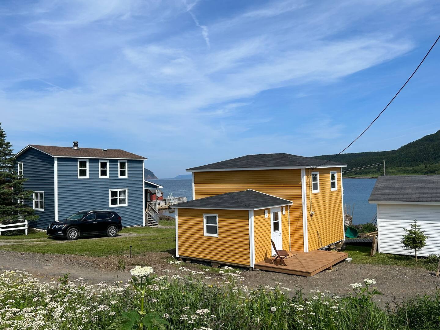
Roddickton-Bide Arm
Where the boreal forest meets the sea, Roddickton-Bide Arm is a testament to resilience and reinvention. Located on Newfoundland’s Great Northern Peninsula, 275 km north of Deer Lake, the community formed in 2009 through the amalgamation of Roddickton and Bide Arm.
Roddickton, founded in 1906 by the Grenfell Mission, grew around a sawmill and was later named after Dr. Thomas G. Roddick. Bide Arm, once a wintering site for Englee residents, became a permanent settlement in 1969 when 186 residents from Hooping Harbour resettled there. By 1971, it was officially incorporated with essential services. The two towns united to strengthen their future following the 1994 fishing moratorium.
Known as the "Moose Capital of the World," Roddickton-Bide Arm has the highest moose density in North America, with six moose per square kilometer. Decades of logging created ideal moose habitat, transforming the animal from a nuisance into a local icon.
Surrounded by breathtaking scenery, including the Cloud Mountains and the Sleeping Giant, the town offers stunning trails, pristine waters, and a sky untouched by city lights—an adventurer’s paradise. Here, the rugged landscape and the tenacity of its people shape a community deeply connected to its history and the wilderness.


Photography by Jennifer Gillard
Englee
Englee is a picturesque fishing community perched along the rugged coastline of the Great Northern Peninsula. With roots stretching back to the early 1800s, the town was built on the inshore fishery, where generations of hardworking families thrived along its bountiful waters.
Though the cod fishery collapse in the 1990s brought challenges, Englee's resilient residents adapted while preserving their deep maritime heritage. Today, the town remains a testament to Newfoundland’s enduring spirit, where tradition and perseverance shape daily life for its nearly 490 residents.
Surrounded by dramatic cliffs, rolling hills, and vibrant coastal landscapes, Englee’s natural beauty is truly captivating. In summer, wildflowers paint the rocky terrain in brilliant colors, while fishing boats and drifting icebergs dot the deep blue waters. Towering evergreens and wind-swept spruce frame the town against misty mountains and the open Atlantic.
Hiking trails offer panoramic views, drawing both locals and visitors to experience Newfoundland’s raw, untamed wilderness. Whether it’s the salty breeze, the sound of crashing waves, or the warmth of a neighbor’s greeting, Englee is a hidden gem where nature and community exist in perfect harmony—leaving a lasting impression on all who visit.


Photography by Tom Cochrane
Main Brook
Tucked away on picturesque Hare Bay, Main Brook is a haven for nature lovers and history seekers.
Nestled in a valley with a deep harbour known as "Safe Haven," the town is surrounded by islands, salmon rivers, and brackish ponds. Each summer, humpback, minke, and fin whales, drifting icebergs, and seabirds animate the coastline.
Founded in the 1920s with a sawmill that spurred a thriving logging industry, Main Brook grew rapidly after the Bowater Company established a shipping depot in the 1940s. Incorporated in 1949, the town once boomed with over 800 residents. As forestry declined, the community shifted its focus to outdoor recreation and ecotourism.
Today, with just over 240 residents, Main Brook is renowned for snowmobiling, fishing, hunting, and fly fishing. Its long winters, snow-covered bogs, and rugged terrain offer unparalleled adventure. Conservation efforts protect salmon rivers and habitats for whales, puffins, and eider ducks, with large parts of Hare Bay designated as conservation areas. Birdwatching, iceberg viewing, and wildlife tours showcase caribou, moose, and black bears.
Rooted in nature and heritage, Main Brook invites visitors to experience its beauty and tranquility while the community continues to seek sustainable economic growth.


Photography by Ian & Hans Van Klinden
Conche
On the rocky shores of the Northeast Secret Path lies Conche, a resilient village of around 130 residents, shaped by generations of fishermen and artisans.
Originally a seasonal outpost for the French, it later became a permanent settlement for Irish families who guarded the fishing stations through the harsh winters.
Today, Conche is celebrated for its deep-rooted Irish Newfoundland culture and its rich history, brought to life through the French Shore Interpretation Centre and the remarkable 220-foot-long French Shore Tapestry—an intricate embroidery depicting Newfoundland’s storied past.
The town, home to a busy fish plant, a church, a community hall, a post office, a small parish gathering space, a convenience store, and a municipal building with a community gym, stands as a testament to the enduring spirit of outport communities.
Surrounded by spruce-clad mountains rising 150 meters along the rugged coastline, Conche offers endless natural beauty and outdoor exploration. Dozens of hidden beaches, secret coves, waterfalls, freshwater ponds, and historic trails invite visitors to uncover the peninsula’s many stories.
Each season brings its own charm—icebergs drift into the harbour in June, whales grace the bays throughout summer, and berry-picking thrives under the warm August sun. Conche is a place where nature and history intertwine, offering a rare glimpse into Newfoundland’s past and the vibrant life that endures along its shores.


Photography by Melissa Cherry
Croque
Perched on the northeastern coast, Croque is a place where history lingers in the salt air.
Once a stronghold of the French migratory fishery, its name—meaning “hook” in French—reflects its past as a haven for fishermen braving the North Atlantic. With fewer than 50 residents, the village preserves its heritage through centuries-old gravesites, rustic bread ovens, and echoes of its once-thriving fishing industry.
The French Naval Cemetery, dating to the 1700s, holds the graves of French and English sailors, a testament to Croque’s role in the migratory fishery. The French Navy tended the site every summer until 1970, keeping its legacy alive. The village’s well-protected, hook-shaped bay served as a key stop for French fishing ships in the 1600s before they dispersed to nearby harbors.
Reaching Croque is an adventure—via Route 438, a gravel road off Route 432 south of Main Brook. With no services along the way, travelers should fuel up and bring supplies. After the rugged 16-kilometer drive to Croque, another 9 kilometers leads to Grandois-St. Julien’s, where weathered waterfront buildings stand as hauntingly beautiful reminders of the village’s fishing heritage.


Photos by Bob & Linda Brown
Around Our Towns
The latest photos from Northeast Secret Path, submitted by travellers and residents