


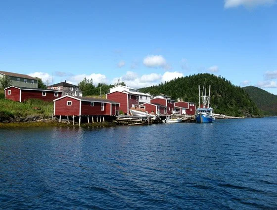
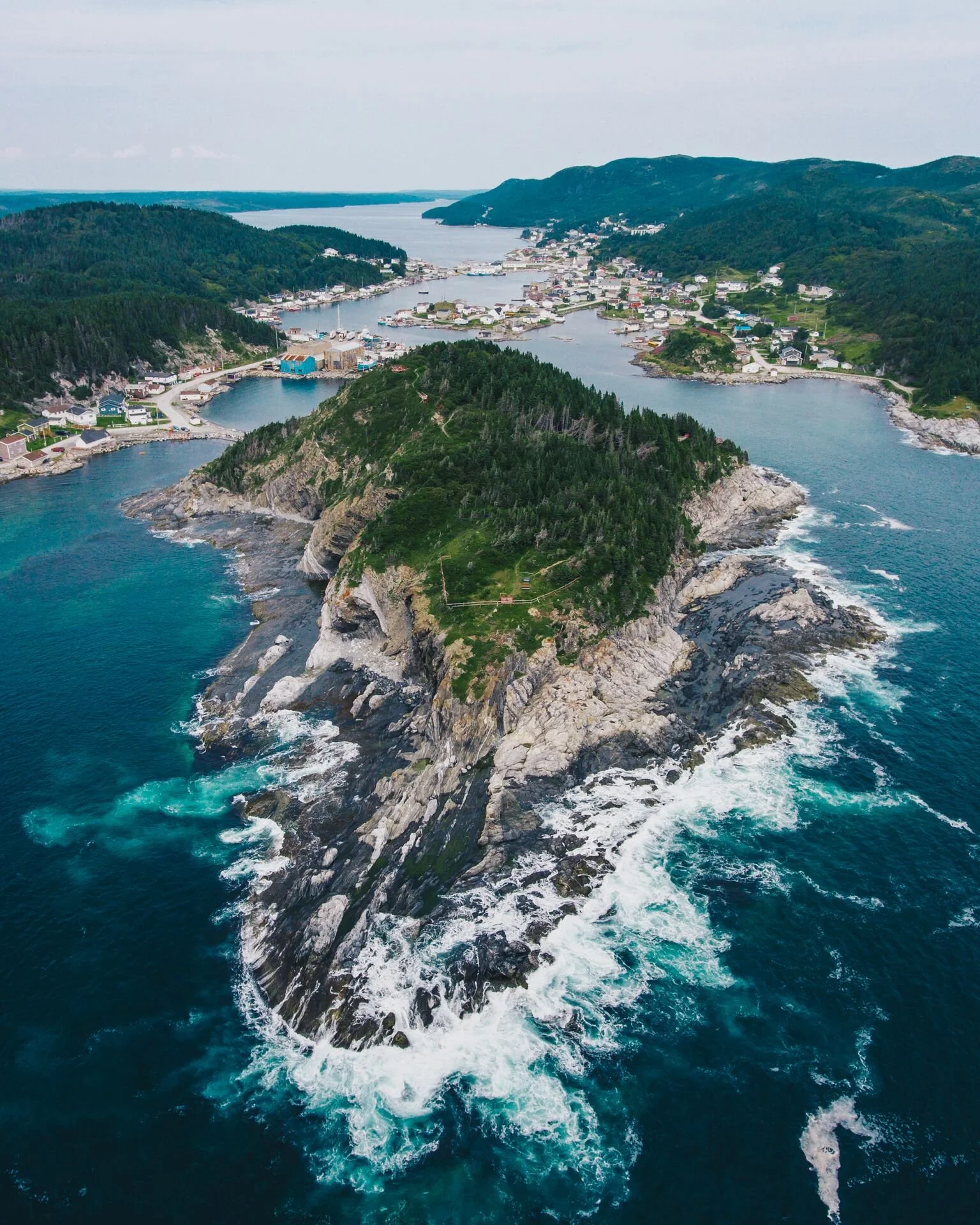
Englee
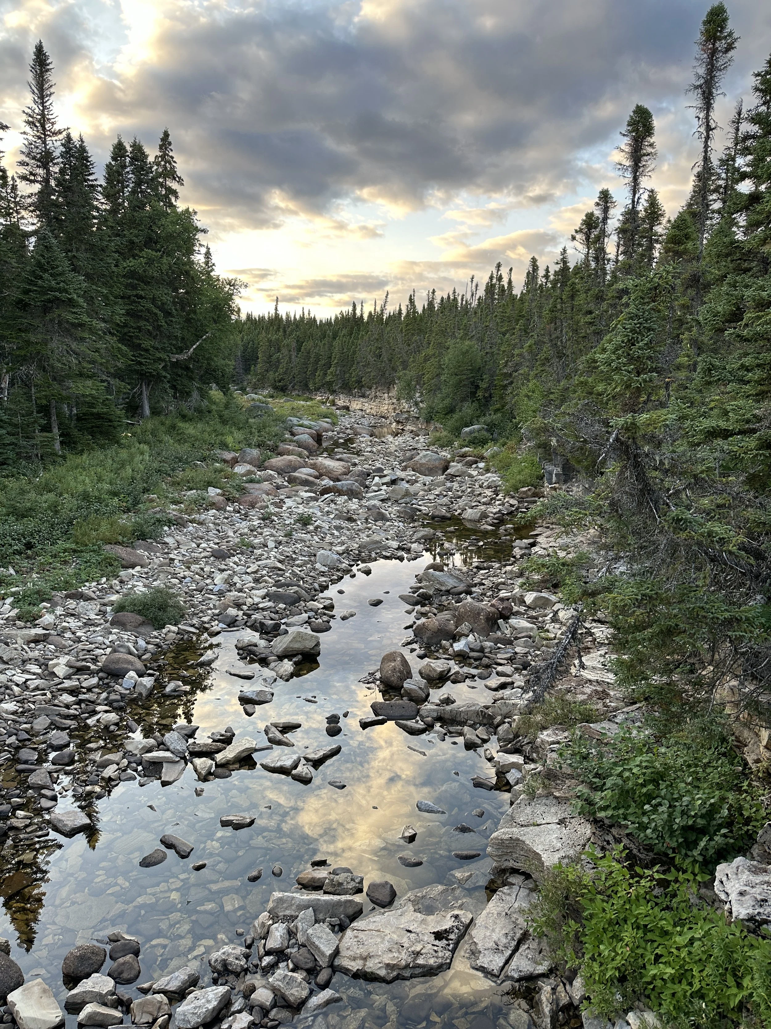
This stunning coastal hike follows the rugged outline of Englee Island, offering breathtaking views and unique natural features. Along the way, hikers will pass White Point, where brilliant white Cambrian marble gleams in the sun, and wander through the Enchanted Forest, where twisted trees create a magical atmosphere.
Well-placed lookouts provide panoramic views of Canada Bay and Englee’s coastline, while beach access points invite hikers to dip their feet or explore the shoreline. The trail ends at Grévigneaux Harbor, with an optional scenic walk back through town, where friendly locals add to the experience.
Wildlife is abundant—watch for whales, seals, seabirds, and fishing boats navigating the waters. Whether seeking adventure, tranquility, or spectacular scenery, White Point Trail is an unforgettable coastal escape.

Quick Facts for Hikers
Distance: ~6 km (out-and-back)
Duration: ~2 to 3 hours (depending on pace and stops)
Difficulty: Moderate – some inclines, uneven terrain, and rocky sections
Trail Type: Out-and-back
Elevation Gain: ~210 m
Best Time to Hike: May to October (best weather conditions, wildlife spotting)
Trailhead Location: Near White Point, Englee
Terrain: Coastal cliffs, rocky paths, and forested sections
Notable Features: Ocean views, historic fishing village remnants, possible iceberg sightings in season
This breathtaking coastal trail showcases Englee’s rugged beauty, winding through forested paths and rocky terrain to stunning ocean views and hidden natural gems. The salty sea breeze, birdsong, and wild berries create an unforgettable outdoor experience.
Key stops include Marconi Lookout, offering a glimpse into history with striking coastal views, and Wilson’s Pond and Batteau Cove Pond, peaceful rest spots perfect for quiet reflection. At George’s Hill Gazebo, take in a unique perspective of Englee before reaching Locker’s Point, where waves crash against dramatic cliffs and the vast Atlantic stretches to the horizon.
Whether you're an avid hiker or seeking a peaceful escape, this trail is a true taste of Newfoundland’s natural beauty.


Quick Facts for Hikers
Distance: ~4.5 km (loop)
Duration: ~1.5 to 2 hours
Difficulty: Moderate – some rocky terrain and inclines
Trail Type: Loop
Elevation Gain: ~160 m
Best Time to Hike: May to October for optimal conditions
Trailhead Location: At the end of Church Hall Road
Terrain: Forested paths, rocky coastline, and scenic viewpoints
Notable Features:
Marconi Lookout – Historic site with sweeping coastal views
Wilson’s Pond & Batteau Cove Pond – Peaceful rest stops with serene water views
George’s Hill Gazebo – A scenic overlook of Englee and the coastline
Locker’s Point – Stunning panoramic views of the Atlantic Ocean and dramatic cliffs
Wildlife: Possible sightings of whales, seabirds, seals, and fishing boats
Atmosphere: Tranquil, with salty sea breezes, birdsong, and seasonal wildflowers
This breathtaking coastal hike blends dramatic landscapes, rich history, and raw Newfoundland beauty. Hikers can ascend cliffside steps to higher elevations, pausing at landings to soak in the panoramic views, or follow an alternative shoreline route, where ancient rock formations and hidden sea caves reveal the power of the Atlantic.
Scenic lookouts offer front-row seats to icebergs drifting through the bay, with views of Canada Harbour, a resettled fishing community, and the site of Newfoundland’s worst sealing disaster, immortalized in Death on the Ice. During fishing season, the bay comes alive with boats, while whales frequently breach the surface, creating unforgettable moments.
Whether climbing for sweeping ocean views or tracing the rugged coast where land and sea collide, Barr’d Island Trail is an adventure woven with history, nature, and awe-inspiring beauty.
Quick Facts for Hikers
Distance: ~4 km (loop)
Duration: ~1.5 to 2 hours
Difficulty: Moderate – some uneven terrain and coastal exposure
Trail Type: Loop
Elevation Gain: ~120 m
Best Time to Hike: May to October for best conditions
Trailhead Location: At the end of Marine Side Drive
Terrain: Coastal cliffs, forested sections, and open meadows
Notable Features:
Stunning Coastal Views – Sweeping panoramas of the Atlantic Ocean and rugged cliffs
Island Overlooks – Unique vantage points of Barr’d Island and nearby rocky outcrops
Wildlife Viewing – Keep an eye out for whales, seals, seabirds, and fishing vessels
Serene Forested Paths – A mix of coastal exposure and sheltered woodland areas
Rocky Shoreline Access – Opportunities to explore the shoreline and take in the crashing waves
Atmosphere: A peaceful yet dramatic coastal landscape, perfect for those seeking solitude and connection to nature
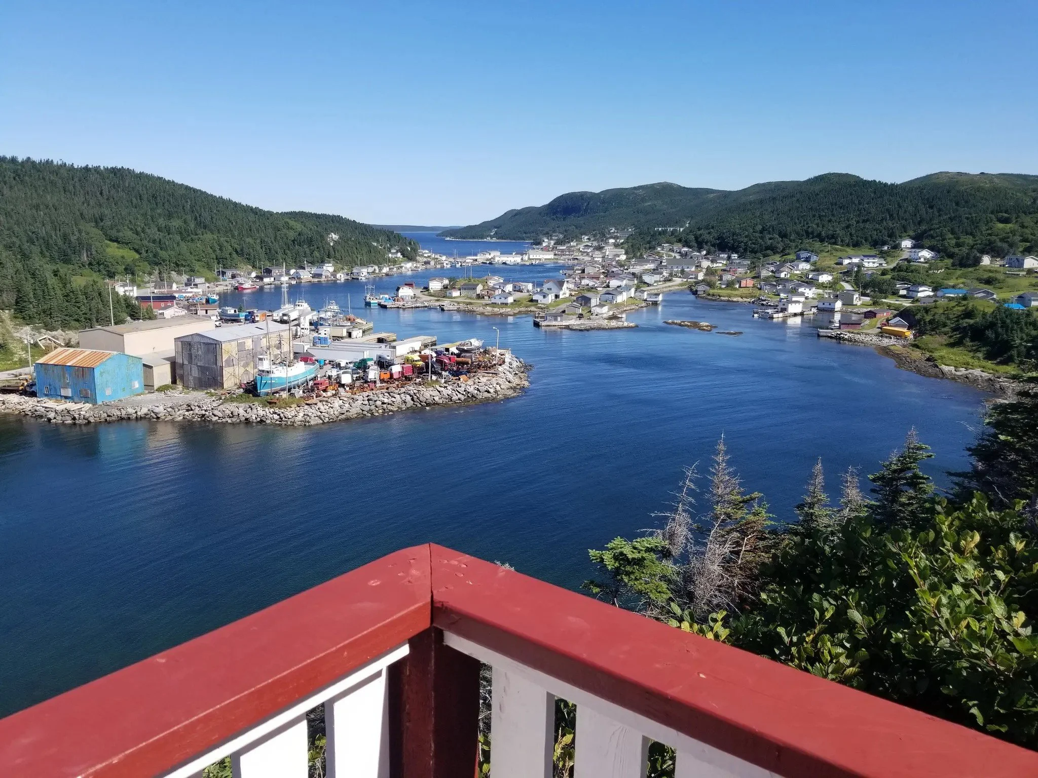
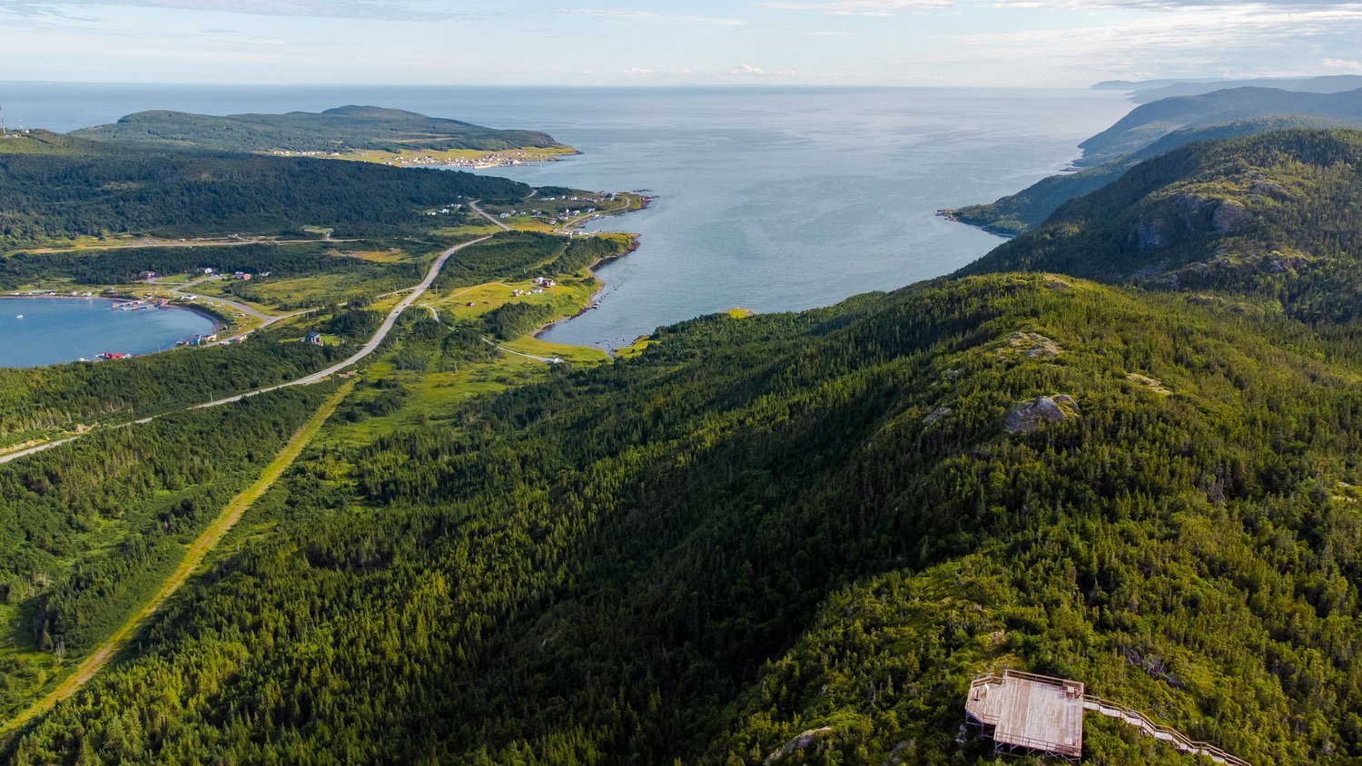
Shoe Pond Trail
The Shoe Pond Trail in Englee, Newfoundland, is a challenging but rewarding 2 km hike that takes adventurers through forest-covered hills and steep ascents before unveiling breathtaking panoramic views of Englee, Canada Bay, and the rugged coastline.
This strenuous trail features a mix of natural terrain and boardwalks, requiring proper footwear as some sections can be muddy or wet. Along the way, hikers are immersed in birdsong, rustling trees, and the crisp, earthy aroma of the wilderness. After the toughest climb, a gazebo at the summit provides a perfect resting spot, offering some of the most spectacular views in Newfoundland. For those who venture a little higher, a Canadian flag at the steepest peak marks the ultimate vantage point.
Built with incredible effort, the trail features rest stops, bridges, and well-placed lookouts, making the demanding journey all the more rewarding. Whether you're a local or a visitor, Shoe Pond Trail is an unforgettable experience showcasing the raw beauty of Newfoundland’s remote landscapes.


Quick Facts for Hikers
Distance: ~2 km (out-and-back)
Duration: ~1 to 1.5 hours
Difficulty: Strenuous – steep inclines, natural terrain, and boardwalks
Trail Type: Out-and-back
Elevation Gain: ~200 m
Best Time to Hike: May to October for best conditions
Trailhead Location: Near the basketball courts in Englee, Newfoundland & Labrador
Terrain: Forested paths, steep hills, boardwalks, and rocky sections
Notable Features:
Gazebo at the Summit – A perfect rest stop with panoramic views
Steepest Peak with a Canadian Flag – The ultimate vantage point over Englee
Wildlife Spotting – Look for seabirds, moose, and other wildlife
Well-Constructed Trail – Bridges, rest stops, and boardwalks enhance the journey
Challenging but Rewarding – One of Englee’s most breathtaking climbs
Atmosphere: Strenuous, scenic, and offering unparalleled coastal views
Conche
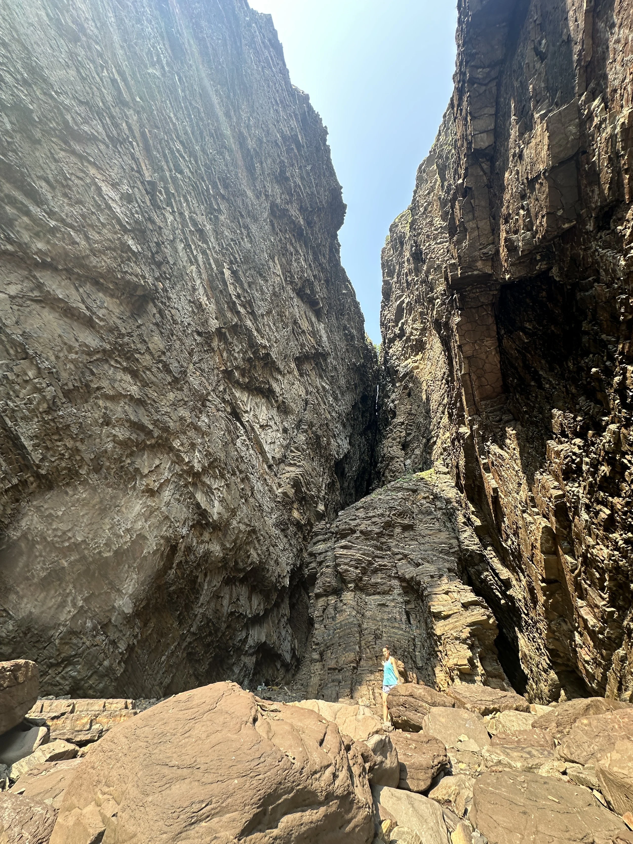
Winding through rugged coastal terrain, Glass Hole Trail is a stunning hike that showcases Newfoundland’s raw beauty. This moderate 4 km loop takes hikers through a mix of forested paths, rocky cliffs, and windswept barrens, leading to its most captivating feature—the Glass Hole, a striking ocean-carved fissure where waves crash and churn below.
Along the way, panoramic views of the Atlantic stretch endlessly, with lookouts offering prime spots to watch for whales, seabirds, and drifting icebergs. The trail also reveals unique geological formations, shaped by centuries of wind and water, creating an otherworldly landscape that feels both wild and serene.
Whether you're drawn by the thrill of coastal cliffs, the mystery of the Glass Hole, or the chance to experience Newfoundland’s untamed beauty, this trail delivers an unforgettable adventure.

Quick Facts for Hikers
Distance: ~5 km (round trip)
Duration: ~3-4 hours
Difficulty: Moderate – some rocky and uneven terrain
Trail Type: Out-and-back
Elevation Gain: ~120 m / 400 ft
Best Time to Hike: May to October for best conditions
Trailhead Location: Near the Boston BZ277 Crash Site in Conche
Terrain: Coastal cliffs, forested sections, and open barrens
Notable Features:
The Glass Hole – A dramatic ocean-carved cave with crashing waves below that you may dare to climb
Panoramic Coastal Views – Stunning outlooks over the Atlantic Ocean
Wildlife Spotting – Look for whales, seabirds, and seasonal icebergs
Unique Geological Formations – Rock features shaped by wind and sea
Serene Forested Paths – A peaceful contrast to the rugged cliffs
Atmosphere: A wild and remote coastal adventure with breathtaking scenery
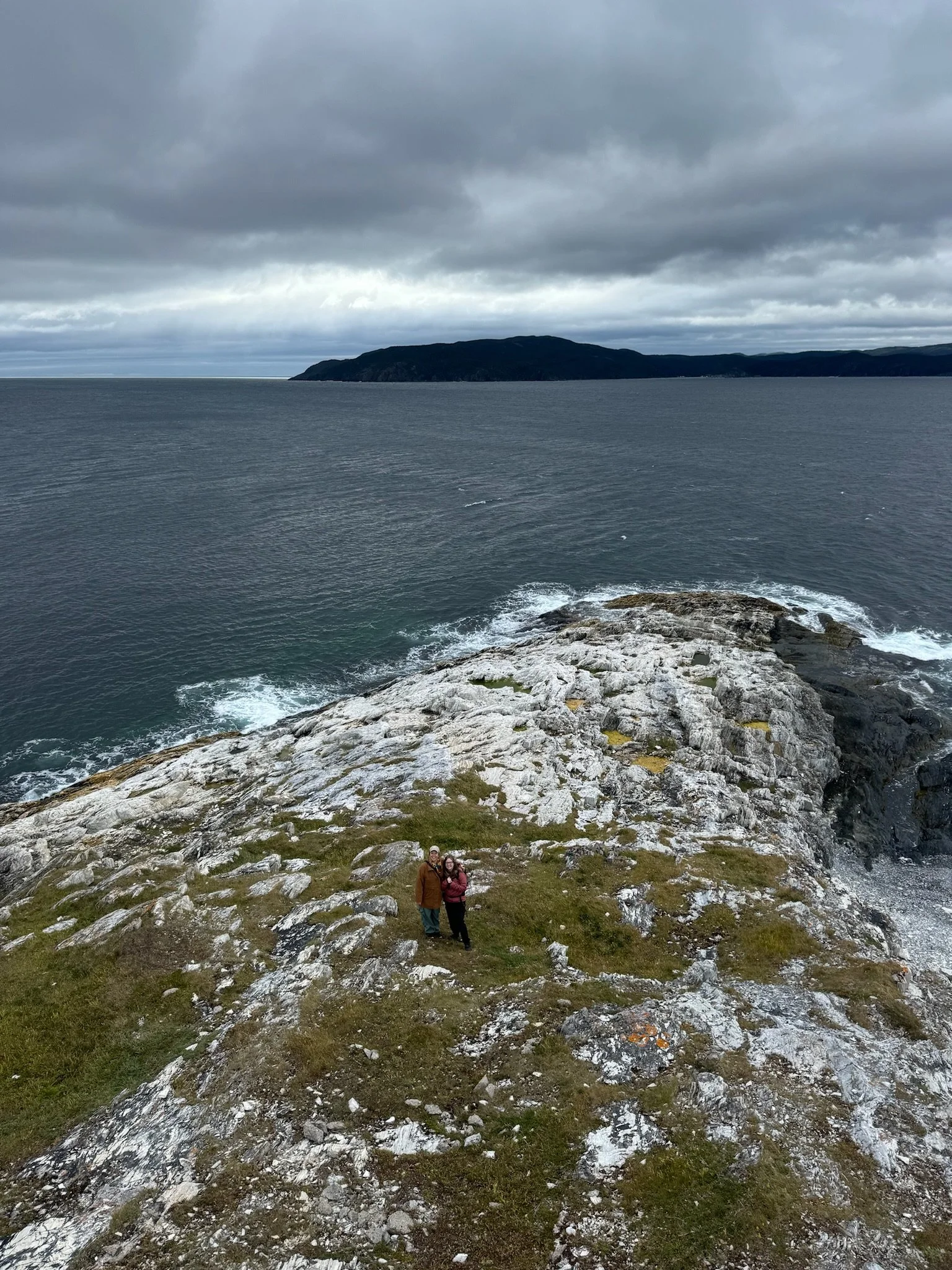
Perched high above the rugged coastline, Sailor Jack’s Hill Lookout offers sweeping views of the entire Conche Peninsula and the vast, untamed beauty of the Grey Islands beyond. This short yet rewarding hike follows a well-maintained boardwalk and staircase, guiding hikers to a breathtaking vantage point where land and sea collide in spectacular fashion.
From the summit, the dramatic cliffs, rolling hills, and endless Atlantic horizon create an unforgettable scene, making this an ideal stop for photographers, nature lovers, and those seeking a quiet moment of reflection. On clear days, the Grey Islands rise from the water like sentinels, while seabirds soar overhead, carried by the ocean breeze.
Whether you're stopping for a quick climb or lingering to take in the view, Sailor Jack’s Hill Lookout is a must-visit destination for anyone exploring Conche.

Quick Facts for Hikers
Distance: ~1 km (out-and-back)
Duration: ~30 minutes to 1 hour
Difficulty: Easy – short climb with stairs and boardwalk
Trail Type: Out-and-back
Elevation Gain: ~50 m
Best Time to Hike: May to October for clear views
Trailhead Location: Before descending into Conche
Terrain: Boardwalk, stairs, and rocky outcrops
Notable Features:
Panoramic Views – Overlooks the Grey Islands and Conche Peninsula
Well-Maintained Path – Boardwalk and staircase for easy access
Wildlife Spotting – Look for seabirds, whales, and icebergs in season
Ideal for Photography – Stunning coastal landscapes and dramatic horizons
Short & Rewarding – A quick yet breathtaking stop for all visitors
Atmosphere: Serene, windswept, and perfect for reflection
Captain Coubelongue Trail
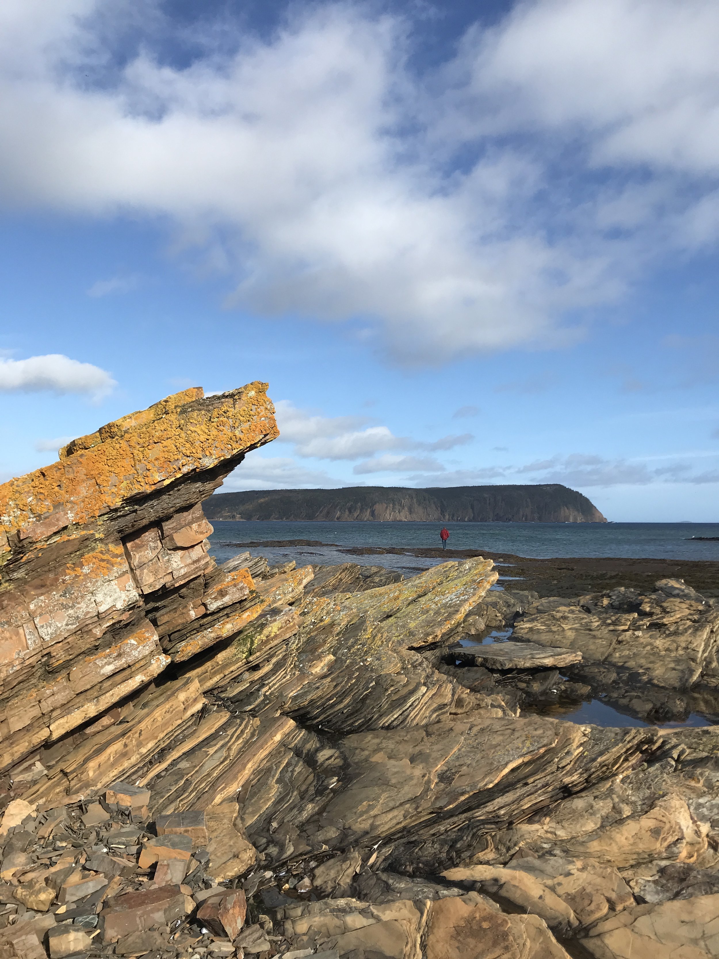
The Captain Coubelongue Trail is a scenic crushed stone path that follows the rugged coastline of Southwest Crouse, offering breathtaking ocean views and a direct connection to Newfoundland’s French fishing heritage. This peaceful trail winds along the shoreline, making it an ideal spot for wildlife viewing, photography, and quiet reflection.
The trailhead features the Captain Coubelongue Gravesite, a designated municipal heritage site and a poignant reminder of the region’s past. This solitary grave, dating to 1873, is marked by a simple cross and enclosed by a low fence, with a short staircase leading to an interpretive sign explaining its significance. Local oral history tells of Captain Jacques Coubelongue, a French fishing captain whose sudden death led to his burial in isolation rather than in a cemetery. His grave stands as a powerful link to the French Shore, where French fishermen held treaty rights from 1713 to 1904.
As the trail continues along the coastal landscape, hikers can take in sweeping views of the Atlantic and the cobbled beach once used for drying cod. The combination of history, solitude, and natural beauty makes the Captain Coubelongue Trail a must-visit destination for those looking to experience both the landscape and legacy of Newfoundland’s storied coastline.

Quick Facts for Hikers
Distance: ~2 km (out-and-back)
Duration: ~30 to 45 minutes
Difficulty: Easy – gentle terrain with a crushed stone path
Trail Type: Out-and-back
Elevation Gain: Minimal
Best Time to Hike: May to October for best conditions
Trailhead Location: Southwest Crouse, near Conche
Terrain: Crushed stone path along the coastline
Notable Features:
Captain Coubelongue Gravesite – A historic 1873 French fishing captain’s grave at the trailhead
Sweeping Coastal Views – Stunning panoramas of the Atlantic Ocean
Wildlife Spotting – Look for whales, seabirds, and fishing boats in season
Historic French Shore – Once a seasonal French fishing station from 1713 to 1904
Cobbled Beach – Once used for drying cod during the peak of the fishery
Atmosphere: Peaceful, reflective, and rich in history

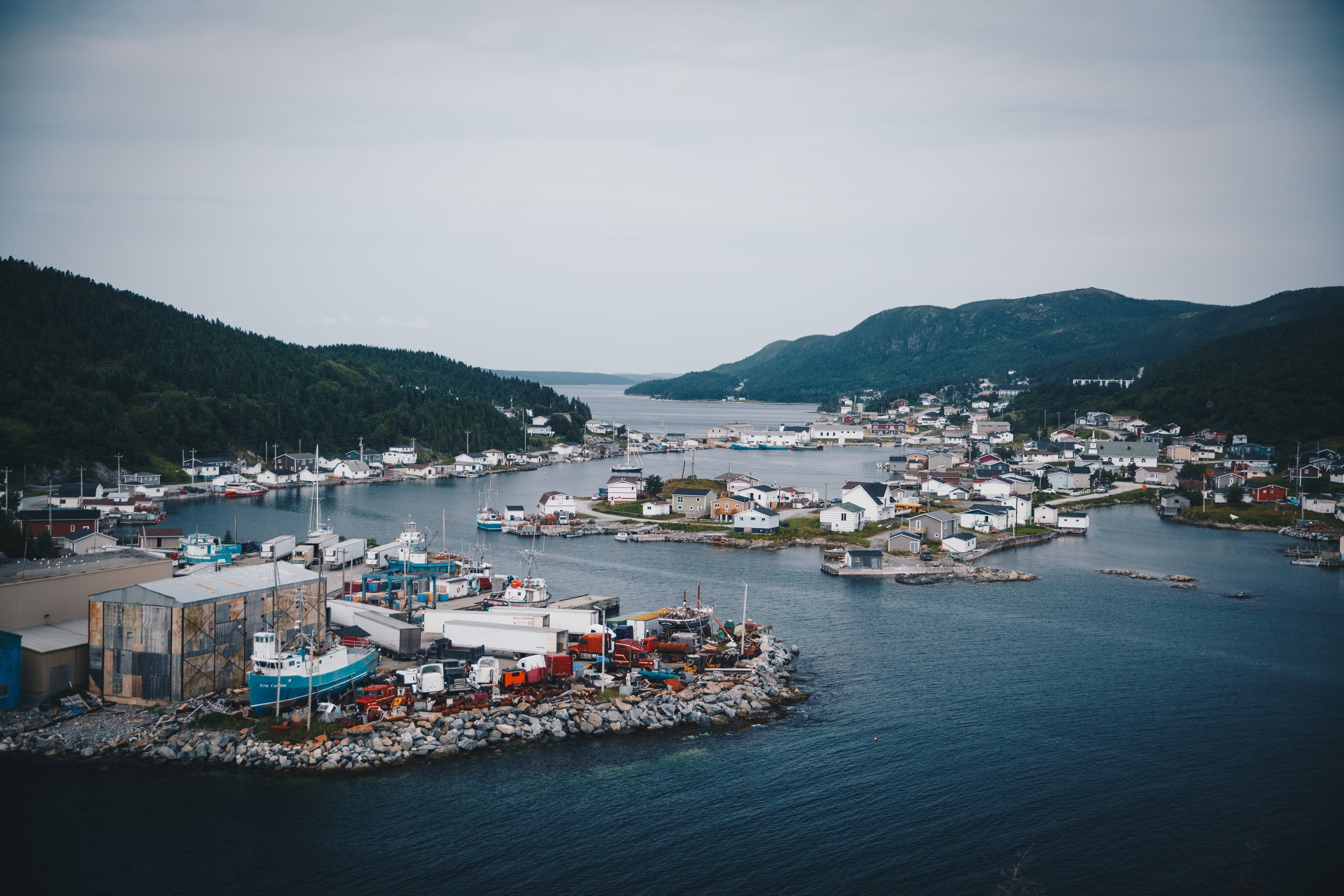
Roddickton-Bide Arm
Underground Salmon Pool
Located 12 km from Conche Branch and about 15 km from Roddickton, the Underground Salmon Pool is a must-see destination for nature lovers and wildlife enthusiasts. Even if you’re not an angler, witnessing this incredible phenomenon is an unforgettable experience. Here, Atlantic salmon navigate their migration route by disappearing into an underground limestone tunnel before re-emerging further upstream.
The best time to visit is late summer, when the salmon are actively leaping and making their way through the hidden passage. A viewing platform along the short, scenic trail provides the perfect vantage point to observe this rare natural event.
Whether you're a seasoned wildlife watcher or simply passing through, the Underground Salmon Pool is a remarkable natural wonder, offering a glimpse into the resilience of Newfoundland’s wild and untamed landscapes.


Quick Facts for Wildlife
Watchers & Hikers
Duration: ~10 to 15 minutes one way
Location: ~12 km from Conche Branch, ~15 km from Roddickton
Best Time to Visit: Late summer (July–September) for peak salmon migration
Trail Length: ~400 m (out-and-back)
Difficulty: Easy – short walk with gentle terrain
Elevation Gain: Minimal
Trail Type: Out-and-back
Terrain: Gravel and forested path with a viewing platform
Notable Features:
Unique Natural Phenomenon – Watch Atlantic salmon disappear into an underground limestone tunnel before re-emerging upstream
Scenic Viewing Platform – Offers a great vantage point for observing salmon and surrounding nature
Wildlife Watching – Potential to see seabirds, small mammals, and other aquatic life in the area
Remote & Peaceful Setting – A quiet, lesser-known spot for nature lovers and photographers
Atmosphere: A serene and fascinating wildlife experience, perfect for those interested in salmon migration, nature photography, and peaceful outdoor exploration.
The Farm Trail
Once home to a World War II radar site, The Farm in Roddickton-Bide Arm has transformed into a cherished community park, brimming with potential for green space expansion and future economic opportunities. This scenic area serves as a gathering place where residents and visitors alike can enjoy the great outdoors, surrounded by the region’s natural beauty.
The area’s agricultural roots run deep—Kenneth Adams is believed to have established the first farm here over a century ago, proving that the Great Northern Peninsula’s rugged terrain could sustain farming. His success paved the way for others, inspiring gardens and greenhouses throughout the region. Today, The Farm stands as a testament to the area’s rich history and its untapped potential for further agricultural growth, particularly in Roddickton.
With a blend of history, community spirit, and fertile land, The Farm Trail is more than just a walk—it’s a glimpse into the past and a vision for the future of sustainable agriculture on the Great Northern Peninsula.


Quick Facts for Hikers
Distance: ~3 km (out-and-back)
Duration: ~45 minutes to 1 hour
Difficulty: Easy – mostly flat terrain with some uneven ground
Trail Type: Out-and-back
Elevation Gain: Minimal
Best Time to Hike: May to October for the best conditions
Trailhead Location: Follow Marine Drive in Roddickton
Terrain: Forested paths with grassy clearings and historical landmarks
Notable Features:
World War II Radar Site – Former military installation, now a peaceful green space
Historic Agriculture – Site of one of the first farms in the region, dating back over 100 years
Scenic Green Space – Open areas perfect for picnics and relaxation
Local Wildlife – Keep an eye out for birds, small mammals, and seasonal wildflowers
Atmosphere: A blend of history, nature, and community spirit in a tranquil setting
This park in Bide Arm, NL, offers a scenic and reflective journey through the region’s maritime and resettlement history. Named after the schooner Armistice, built on Armistice Day, 1918, the trail highlights the vessel’s legacy before it sank off Spain in 1923.
Winding through Armistice Park, this 2 km loop features gravel and forested paths, gentle elevation, and interpretive panels detailing Bide Arm’s creation under the 1969 Resettlement Act. Homes from outports like Hooping Harbour and Englee were floated here, forming the only community built through government resettlement.
With coastal views, historical insight, and a peaceful setting, the Armistice Trail is a must-visit for hikers, history buffs, and nature lovers alike.


Quick Facts for Hikers
Distance: ~2 km (loop)
Duration: ~30 to 45 minutes
Difficulty: Easy – well-maintained path with gentle terrain
Trail Type: Loop
Elevation Gain: Minimal
Best Time to Hike: May to October for the best conditions
Trailhead Location: Armistice Park, Bide Arm
Terrain: Gravel and forested paths with scenic viewpoints
Notable Features:
Historic Schooner Connection – Named after the Armistice, built on November 11, 1918, and lost off Spain in 1923
Resettlement Story – The only community created under the 1969 Resettlement Act, with homes floated from outports like Hooping Harbour and Englee
Interpretive Panels – Learn about the region’s maritime and settlement history along the trail
Scenic Views – Overlooks of Bide Arm’s rugged coastline and surrounding landscapes
Atmosphere: A peaceful and historically rich trail offering insight into Newfoundland’s resettlement era and maritime past.
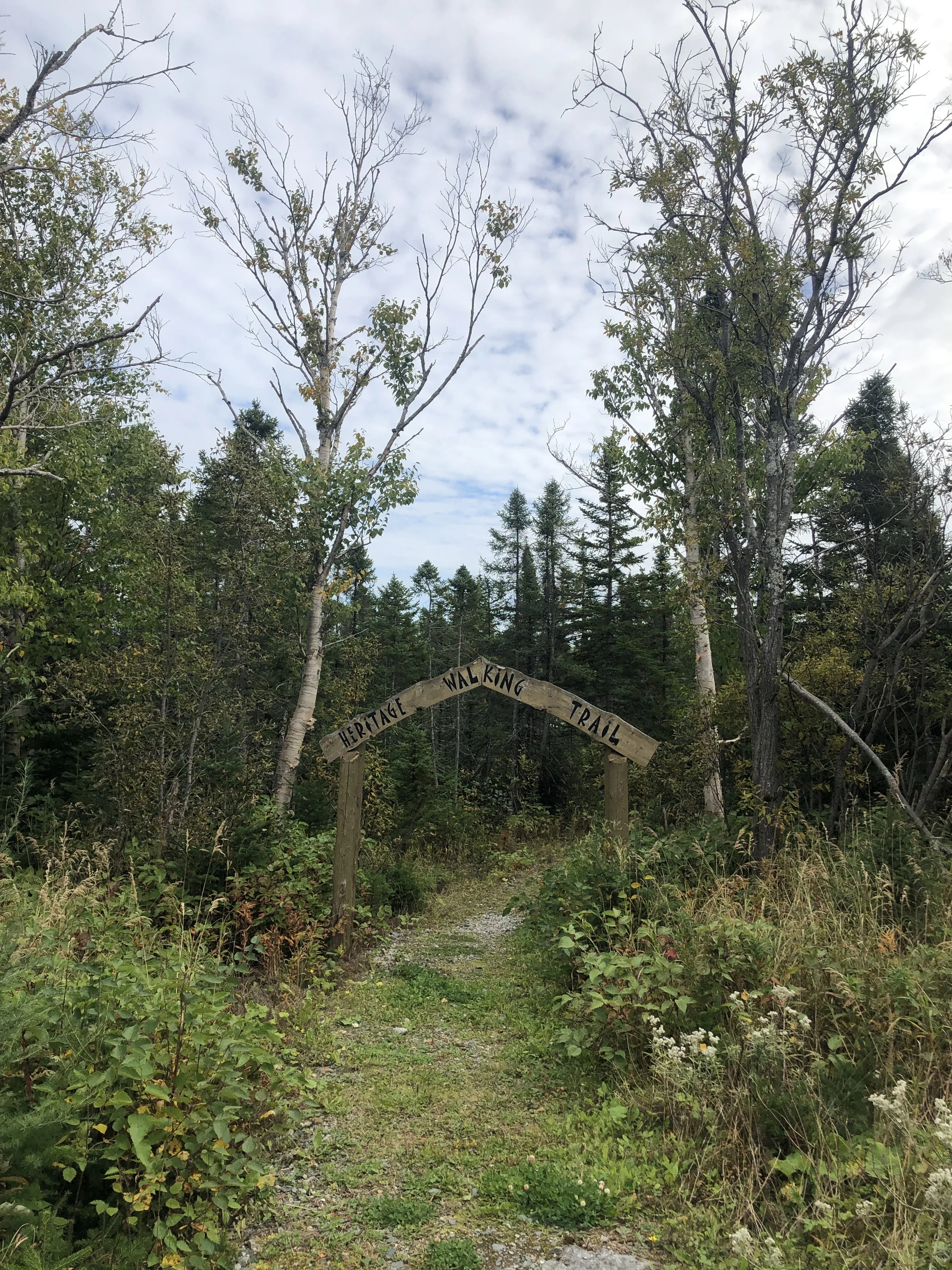
The Heritage Walk in Roddickton-Bide Arm is a picturesque 2.5-kilometre loop that winds around Muddy Hole Pond, offering a peaceful retreat into nature right in the heart of town. Starting just behind the Town Office and Green Moose Interpretation Centre, the trail immerses visitors in a tranquil setting where dense forest, wildlife, and the gentle ripples of the pond create a perfect backdrop for reflection and relaxation.
Along the route, gazebos and rest areas provide ideal spots to pause, take in the surroundings, and even enjoy a picnic. The area is rich in birdlife, making it a great spot for nature enthusiasts and photographers looking to capture a glimpse of local species. With a well-maintained path and a welcoming atmosphere, the Heritage Trail is accessible to walkers of all ages and abilities, offering a perfect mix of exercise, fresh air, and connection to the landscape.
Whether you’re a resident seeking a daily stroll or a visitor exploring Roddickton-Bide Arm’s natural beauty, the Heritage Trail is a must-experience walk that highlights the town’s deep connection to its environment.

Quick Facts for Hikers
Distance: ~2.5 km (loop)
Duration: ~30 to 45 minutes
Difficulty: Easy – accessible for all ages with gentle terrain
Trail Type: Loop
Elevation Gain: Minimal
Best Time to Hike: May to October for the best conditions
Trailhead Location: Behind the Town Office, Roddickton-Bide Arm
Terrain: Well-maintained gravel and forested paths surrounding Muddy Hole Pond
Notable Features:
Tranquil Atmosphere – A peaceful escape into nature, perfect for a leisurely walk
Cloud Mountains Views – Scenic overlooks of the majestic Cloud Mountains in the distance
Gazebos & Rest Areas – Ideal spots for relaxation, picnics, and birdwatching
Wildlife Viewing – Keep an eye out for local birds and small woodland creatures
Community Connection – A cherished walking route for locals and visitors alike
Atmosphere: A serene and scenic trail that offers stunning mountain views, a calming natural setting, and a leisurely outdoor experience for all ages.
Heritage Walk

Croque
The Epine Cadoret Trail is a captivating out-and-back route leading to the mouth of Croque Harbour, where history is quite literally carved into the landscape. Along this scenic but rugged and unmaintained trail, hikers can discover centuries-old French carvings left behind by sailors in the mid-1800s, offering a rare glimpse into Newfoundland’s maritime past.
However, use this trail at your own risk. The boardwalk is dilapidated and in poor condition and has not maintained, posing potential hazards. The uneven and deteriorating sections require careful navigation, making sturdy footwear essential.
Despite these challenges, the journey is rewarding. Expect stunning coastal views, remote wilderness, and a deep sense of solitude. This trail is ideal for history enthusiasts and experienced hikers willing to take on the risks in exchange for a truly immersive encounter with the past.


Quick Facts for Hikers
Distance: ~3 km (out-and-back)
Duration: ~1 to 1.5 hours
Difficulty: Moderate – rugged terrain with unmaintained sections
Trail Type: Out-and-back
Elevation Gain: Minimal
Best Time to Hike: June to October for best conditions
Trailhead Location: Follow the road towards Grandois-St. Julians
Terrain: Rocky coastal path with deteriorating boardwalk sections – proceed with caution
Notable Features:
French Historic Carvings – 19th-century inscriptions left by French sailors
Remote & Rugged – A secluded trail with stunning coastal views
Boardwalk Hazards – The unmaintained boardwalk is in poor condition – wear sturdy footwear
Wildlife Spotting – Potential to see seabirds and other coastal wildlife
Atmosphere: A historically rich but challenging hike, offering a glimpse into Newfoundland’s French fishing history, best suited for experienced hikers prepared for rough terrain.

Main Brook
The Hare Bay Islands Ecological Reserve is a protected area off the northeast coast of Newfoundland, safeguarding critical nesting habitats for seabirds. Located in Hare Bay, near Main Brook and Englee, this reserve encompasses several small islands that host significant breeding colonies of common eiders, Arctic terns, and great black-backed gulls. The region's rugged coastline and sheltered waters provide an ideal environment for these seabirds to raise their young, making it an essential site for conservation.
Beyond its importance for birdlife, the reserve plays a role in maintaining the broader marine ecosystem of the Great Northern Peninsula. Visitors to the area may spot eiders bobbing on the waves, terns diving for fish, or even witness the dramatic interactions between seabirds and their coastal predators. The protected status of these islands helps preserve a delicate ecological balance, ensuring that future generations can continue to experience the rich biodiversity of Newfoundland’s northeast coast.
While access to the islands themselves is restricted to protect nesting birds, the surrounding waters offer excellent opportunities for wildlife observation. Kayakers, boaters, and birdwatchers can admire the reserve from a respectful distance, witnessing the thriving natural life that defines this remote and pristine part of Newfoundland.


Quick Facts for Nature Lovers
Location: Off Newfoundland’s eastern coast, accessible only by boat
Established: 1964, one of Newfoundland and Labrador’s oldest ecological reserves
Main Purpose: Protects critical seabird nesting habitats, including common eiders and Arctic terns
Best Viewing Time: May to August, when seabirds are nesting and raising their young
Access: Restricted—landing on the islands is prohibited to protect wildlife. Book a boat tour here.
Wildlife Highlights: Common eiders, razorbills, Arctic terns, black guillemots, great black-backed gulls
Marine Life: Seals, fish, and other coastal species thrive in the surrounding waters
Photography & Observation: Best viewed from a boat at a safe distance—binoculars recommended
Conservation Rules: No harvesting, egg collection, or interference with wildlife
Hare Bay Islands Ecological Reserve offers a unique glimpse into Newfoundland’s diverse coastal ecosystem, making it a prime destination for birdwatchers and conservation enthusiasts.